Special Edition Day 3 May 9, 2001
_____________________________________________________________________________________
The Fort Edwards Archaeologist
_____________________________________________________________________________________
Report on the Archaeological Excavations at Fort Edwards, home site of Joseph
Edwards and a French and Indian War frontier fort of Col. George Washington.
This archaeological excavation is part of the ongoing project of The Fort Edwards Foundation of Capon Bridge, West Virginia, to preserve, protect and iterpret the home site and fort site at Joseph Edwards's land grant on the banks of the Cacapon River in Hampshire County, West Virginia. This site represents both an early settler's home of the second quarter of the eighteenth century and a French and Indian War fort in Col. George Washington's chain of forts protecting the Virginia frontier. The excavation is under the direction of Dr. Stephen McBride of Wilbur Smith Associates of Lexington, KY. This page is one of a series of reports on the work.
___________________________________________________________________________________
Day Three - The Excitement Level Rises
More STPs
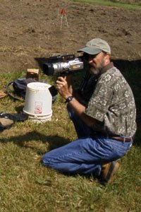
The third day of the dig began with the routine of more shovel test pitsalong the lines laid out yesterday. We were fortunate today to have the assistance of a special friend of history, Ray Schmidt from Real Earth Productions who had come to video some of the activities for us so when we get around to making an introductory movie for our Visitor Center we will have some footage from this dig. Here you see Ray filming Cathy as she digs one of those special square STPs. While Cathy was digging her small pit the crew in the background was trying to determine how to find the rest of what may be the stockade wall that Dr. Gardner found in 1990.
Dr. Gardner's Trench
You will recall that yesterday we began to excavate a test pit to find Dr. Gardner's trench. By the end of the day the team had reached the plastic that Dr. Gardner had placed in his trench before he refilled it. It was too late to go any further yesterday.
Today was the time to continue that pit and uncover Dr. Gardners' plastic 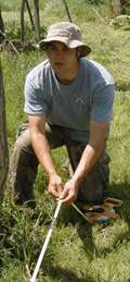 so we could view the feature.
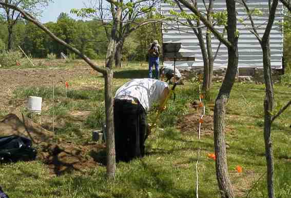
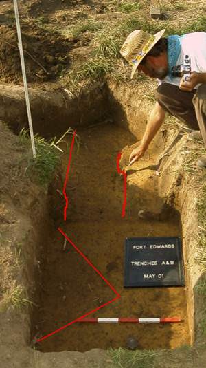
When we uncovered the plastic, the outline of the feature (presumably the stockade wall) was clearly evident. Gardner had been unable in the short time he had to work to find the ends of the trench-like feature. Part of the aim of the current work is to find the outline of the fort. Using the drawing Dr. Gardner did of the feature the team decided to place a larger test pit at the end of Dr. Gardner's trench. After carefully measuring from the wall of the house they decided exactly where to dig.
When they dug down and reached the level of the plastic protecting the earlier work they were delighted to find that the feature continued. However, it abruptly turned and headed in another direction.
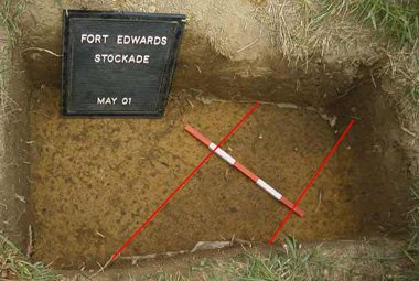
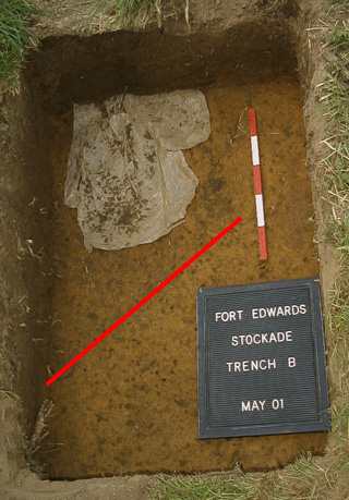
These two photos show on left: Feature A (portion of Dr. Gardner's trench) and on right: Feature B (newly discovered portion of stockade like feature as it makes a sharp turn). The red lines are inserted to show you the outline of the feature.
Connecting the Dots
Because Feature B did not at first appear to run to Feature A, Dr. McBride decided to excavate the dirt between the two pits and see if the features connected. The photo to the right shows the two exploratory pits connected to expose the connection between the features. That connection is not entirely clear. It may be because the features were not originally very deep and the excavation work actually destroyed the connecting area.
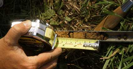
Depth Auger
When archaeologistswant to know how deep a feature is without digging it up (and thereby destroying the feature) they sample a small area with an auger. These pictures show the auger Dr. McBride uses to determine the depth of a feature in the soil. The second photo shows the open side of the auger exposing the core of earth that can be measured to see at what depth the color or composition of the soil changes.
Artifacts of the Day
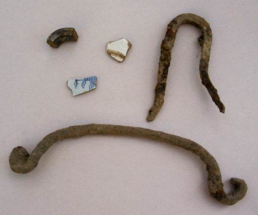
The Artifacts of the Day include the piece of a redward handle (upper left), white salt-glazed stoneware, and the blue & white painted delftware. The larger items are (upper right) an iron staple and the long wrought iron handle.
Volunteers of the Day
Our volunteers today were (left) Isabel Plowright,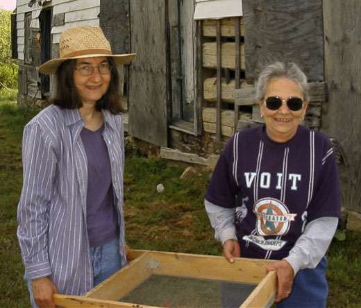 a great supporter of the arts in Hampshire County, and Mabel Voit whom many of you see in the Hampshire County Library. Thank you for your support of our project.
Also thanks to Ray Schmidt
