
The Fort Edwards Foundation of Capon Bridge, West Virginia
|
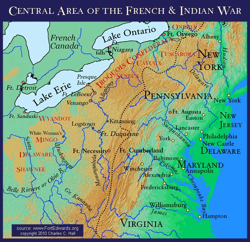
This map shows the area beyond the places George Washington visited and protected during the French and Indian War. It looks north of the area of his trips to Fort LeBoeuf and Philadelphia as well looking westward beyond the campaigns to Fort Duquesne. It also has shown some of the Native American tribes in the region. The dotted line is the Proclamation Line of 1763. Note that although cartographers list areas for Native American tribes, there demarcation was seldom so clear. |