|
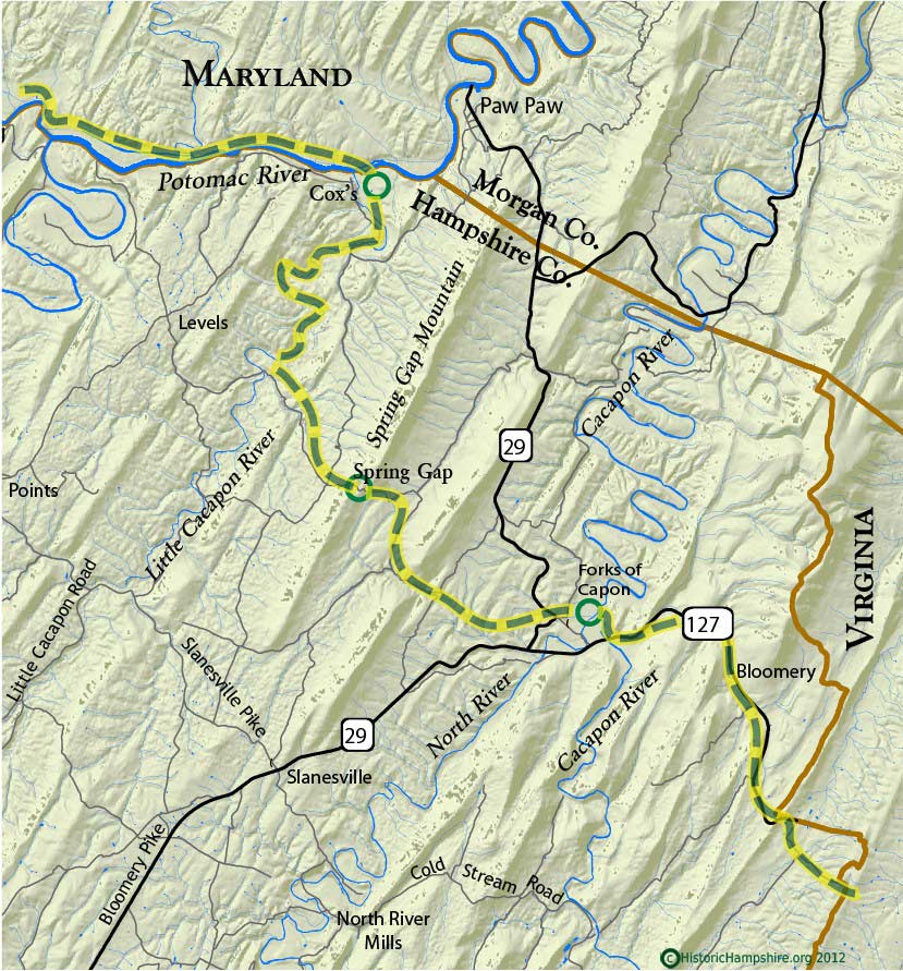
This map shows the road of Gen. Braddock's army (dashed line) from near Whitacre in present day Virginia to Ferry Field at Friend Cox's on the Potomac River. The army entered Hampshire County around Whitacre and continued to Bloomery Run and the crossing of the Cacapon River just downstream of its junction with the North River. Here they had a two day camp. From this point they continued up Spring Gap Mountain where the artillery had to spend the night since the journey up the mountain with the heavy cannon took so much effort and time. The infantry made it in one day to Friend Cox's at what was called Ferry Field on the Potomac. From Ferry Field the army crossed the Potomac River in boats and marched on the Maryland side of the River to Cresap's and then on to Fort Cumberland at Will's Creek.
Copyrighted by HistoricHampshire.org 2012


|
|
|